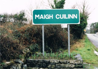
N59 Maigh Cuilinn Bypass
- Other relevant links
- Athenry Northern Ring Road
- N63 Liss to Abbey Realignment Scheme
- N17 Milltown to Gortnagunned Realignment
- N83 Dunmore Rural Regeneration Scheme
- IAPS Eradication
- M6 Service Area
- M17 M18 Gort to Tuam Scheme
- N59 Clifden to Maam Cross
- N59 Maigh Cuilinn Bypass
- R336 Bearna to Scríb
N59 Moycullen Bypass
The proposed N59 Maigh Cuilinn (Moycullen) Bypass Road Project comprises of the construction of a 4.3km standard single carriageway road bypass of Maigh Cuilinn (Moycullen) village and all ancillary works. The project is located entirely within County Galway and extends from the townland of Drimcong approx. 1.5km north-west of Maigh Cuilinn (Moycullen) village to the townland of Claídeach (Clydagh) approx. 2km south-east of Maigh Cuilinn (Moycullen) village.
Objectives for the Proposed Road Development
The general objectives for national road developments were set out in National Development Plan and national and regional planning policy documents. In particular, the National Development Plan 2007 – 2013 as part of the Strategy for National Roads includes the following: -
- to improve the reliability of the road transport system by removing bottlenecks;
- to remedy capacity deficiencies and reduce absolute journey times and journey time variance;
- to improve internal road transport infrastructure between regions and within regions;
- to contribute to the competitiveness of the productive sector and foster balanced regional development;
- to facilitate better access to and from the main ports and airports with the main objective of offsetting the negative effects of peripherality;
- to contribute to sustainable transport policies, facilitating continued economic growth and regional development while ensuring a high level of environmental protection; and
- to help achieve the objectives of the Government’s Road Safety Strategy in relation to the reduction in fatalities and serious injuries caused by road accidents.
Need for the Proposed Road Development
Planning and Development
In terms of planning, the strategic and national need for the proposed road development is supported within a number of national, regional and local policy documents and plans including :-
- Ireland - National Development Plan, 2007-2013 (NDP);
- Infrastructure and Capital Investment 2012-2016 : Medium Term Exchequer Framework
- The National Spatial Strategy 2002 – 2020 (NSS);
- Smarter Travel – A Sustainable Transport Future 2009-2020 (Smarter Travel);
- Regional Planning Guidelines for the West Region 2010-2022,
- Galway County Development Plan 2009-2015,
- Gaeltacht Local Area Plan;
- Moycullen Local Area Plan 2005-2011; and
- National Secondary Road Needs Study (NSRNS).
The project is also listed as a strategic objective of Project Ireland 2040.
Publication of EIS and CPO took place in December 2011. The oral hearing was held over 3 days from the 1st to the 3rd of May 2012. An order approving the proposed road development and confirming the CPO issued by An Bord Pleanala in November 2012.
Deficiencies of the Existing Route
The overall length of existing N59 being improved / replaced by the proposed development is approx. 3.9km and passes through, and forms the main street of Maigh Cuilinn (Moycullen) Village. It consists of both rural and urban sections. The maximum permitted speed limit on the rural sections of the existing route is 100kph. Traffic is restricted to 50kph within Maigh Cuilinn (Moycullen) village 0ver a length of approx. 1.7km. In addition traffic is controlled by signals at the N59 / Knockferry Road / Spiddle Road junction.
These factors, individually and in combination, lead to traffic delay, particularly during peak periods. It is estimated that the proposed road development will generate an average journey time saving of approximately 3 minutes based on the morning (AM) peak traffic flow in the opening year. This journey time saving is predicted to increase to approximately 8 minutes in the design year.
The large volume of through traffic within the village effectively increases community severance and reduces road safety. Conflicting demands on the road network reduces traffic capacity and increases travel times on the national route. The proposed bypass is forecast to result in a 74% reduction in traffic flow in the village north of the signalised junction and a 53 % reduction south of the junction.
The existing N59 carriageway between the Maigh Cuilinn (Moycullen) Speed Limit and the tie-in on the eastern side of the village has a paved width of approx. 5.5m over approx. 90% of its length. It has no hard shoulders and has verges of less than 1m on either side.
The proposed bypass will provide Type 1 single carriageway cross section consisting of a 12.3m paved carriageway bounded by 3m soft verges on each side.
Given the volumes and composition of the existing N59 traffic, the inadequate cross-section along most of the rural sections of road poses a safety risk to all road users, including vulnerable road users. Those with direct access onto the route and those taking access from the local road network in many cases have deficient sight visibility. Pedestrians and cyclists using the route are exposed to particular safety risks due to the inadequacies of the existing route.
The proposed road development includes upgrade works along some of the existing N59 and other local roads to tie-in with the bypass. This includes the provision of footpaths, improvements to junction sightlines and provision of public lighting. These works will address the deficiencies outlined above.
The horizontal and vertical alignments of the existing road provide a stopping and passing sight distance that is completely inadequate for the permitted maximum speed limits over much of the route.
The junctions between the Local Roads and the existing N59 are frequently of poor standard in respect of road width, layout and visibility for vehicles on both the major and minor arms. The high frequency of road junctions and private accesses along rural sections of the N59 give rise to safety problems. These are exacerbated by the composition of traffic involved, comprising a mix of slow and fast moving vehicles and is further compounded by the generally sub-standard cross-section.
The N59 road forms the main street through Maigh Cuilinn (Moycullen) Village and carries
approximately 13,000 vehicles per day including over 450 heavy goods vehicles. This leads to a range of conflicts between locally generated traffic and national through traffic, pedestrian and vehicular traffic, north/south traffic on the Local Road network and east/west traffic on the N59. It is estimated that the volume of heavy goods vehicles will have reached approx. 600 vehicles by 2028. The proposed road development is forecast to lead to a reduction in heavy goods vehicles passing through the village of approx. 67% northwest of the signalised junction and 62% southeast of the junction in the Design year. This equates to a reduction in the volume of heavy goods vehicles of approx. 406 vehicles and 436 vehicles, respectively.
Along the existing N59 there are seventeen at-grade priority junctions with the local road network – eleven of which are located in rural locations with the remaining (6) located within
the speed limit zones. The large majority of these junctions are substandard in relation to alignment and/or layout geometry.
In order to cater for existing traffic the cross roads junction between the N59 and Local Roads L1320 (Spiddle Road) and L1313 (Knockferry Road) in Maigh Cuilinn (Moycullen) village centre has been signalised. This junction controls traffic movement through the village and incorporates pedestrian crossing facilities. The presence of this junction creates a significant traffic bottleneck on the N59 and it contributes to delay to strategic through traffic on the national route, leading to increased journey times and journey time variance.
In addition to the public road junctions, outside of the village speed limit zones, there are ninety (90) access points from houses/farms/fields and commercial undertakings onto the N59 within the study area. Each of these represents a potential road safety hazard and significantly reduces the capacity of the existing road.
Implementation of the proposed road development will lead to a significant reduction in road traffic accidents.
General Description of the Proposed Development
The main elements of the proposed road development include the following:
- 4.3km of National Secondary Road comprising a Type 1 Single Carriageway, in accordance with the cross-section details outlined in NRA TD 27/07. This and the other
relevant cross-sections are summarised in Table ES 2 below. - 4.7 km of local road improvements/realignments including the realignment of the Knockferry road over a distance of approx. 0.85km and upgrading the south east access
from the proposed roundabout to the outskirts of the village for a distance of approx. 1.3km; - 1.7km of farm/ accommodation roads;
- 2 no. at-grade roundabouts;
- 8 structures comprising 5 bridges (including 1 bridge over the proposed N59, 2 bridges over the canal, 1 bridge carrying the proposed N59 over the Lough Kip River and a
- replacement of the existing bridge on the N59 over the Lough Kip River), 2 underpasses and 1 Culvert;
- 5.8km of footway/cycleway;
- Fencing, Drainage and Landscaping Works;
- Environmental Mitigation Measures;
- Utilities and Service Diversion Works;
- Public lighting will be provided in the vicinity of both roundabouts, along the realigned Knockferry Road and improved village access.
- Accommodation Works; and All other ancillary Works.
A compulsory Purchase order for the scheme was confirmed by an Bord Pleanala in November 2012. Notice to Treat was served on the 27th August 2013 and the Notice of Entry
served on 16th of September 2013. The lands were formally entered on the 3rd of October 2013 on foot of the above notice.
Land Acquisition is substantially complete with 93 land cases out of a total number of 108 land cases agreed. Advance contracts in respect of fencing and archaeology are now complete.RPS consultants have been appointed to assist Galway County Council in the preparation of detailed design and contract documents. It is anticipated that contract documents for tendering purposes will be ready in 2021.
Find us
on Facebook
Follow us
on Twitter
Gaeilge
agus Fáilte